|
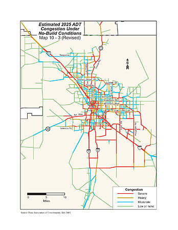
Map from imported GIS file -- An example of a map where the main map is imported from ArcView as a PDF or Illustrator file. The title, neatline, legend, and some additional text is added in FreeHand or Illustrator so all maps and illustrations in the document have the same formatting.
|